Webber-Camden, Minneapolis
Appearance
Webber-Camden | |
|---|---|
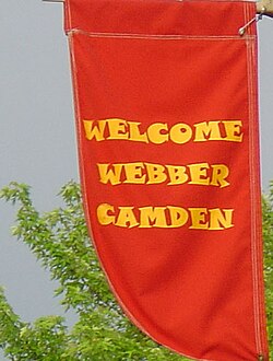
 Banners hanging from streetlights welcome visitors to the Webber-Camden neighborhood | |
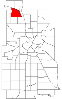
 Location of Webber-Camden within the U.S. city of Minneapolis | |
| Country | United States |
| State | Minnesota |
| County | Hennepin |
| City | Minneapolis |
| Community | Camden |
| City Council Ward | 4 |
| Government | |
| • Council Member | LaTrisha Vetaw |
| Area | |
• Total | 0.92 sq mi (2.4 km2) |
| Population (2020)[2] | |
• Total | 5,744 |
| • Density | 6,200/sq mi (2,400/km2) |
| Time zone | UTC-6 (CST) |
| • Summer (DST) | UTC-5 (CDT) |
| ZIP code | 55412 |
| Area code | 612 |
| Census | Pop. | Note | %± |
|---|---|---|---|
| 1980 | 5,179 | — | |
| 1990 | 4,948 | −4.5% | |
| 2000 | 5,676 | 14.7% | |
| 2010 | 5,097 | −10.2% | |
| 2020 | 5,744 | 12.7% |
Webber-Camden is a neighborhood in the Camden community of Minneapolis. Its boundaries are Penn and Newton avenues to the west, the Canadian Pacific Railway tracks to the north, Interstate 94 to the east, and Dowling Avenue to the south. It is located in Ward 4, represented by council member LaTrisha Vetaw.[3]
The neighborhood was just known as "Camden" until 1995, when the city added "Webber" to the name. Webber Park and Webber Parkway are located in the neighborhood.45°01′45″N 93°17′59″W / 45.0293°N 93.2998°W[4] It is also the home of, and namesake for, Camden High School.[5]
References
[edit]- ^ "Webber-Camden neighborhood in Minneapolis, Minnesota (MN), 55412 detailed profile". City-Data. 2011. Retrieved November 17, 2013.
- ^ "Webber-Camden neighborhood data". Minnesota Compass. Retrieved February 19, 2023.
- ^ "Ward 4". City of Minneapolis. Retrieved April 22, 2024.
- ^ Webber-Camden, Minneapolis, MN. Google Earth. Retrieved 2011-03-09.
- ^ Swanson, Stephen (December 13, 2023). "Minneapolis' Patrick Henry High School to be renamed "Camden High School"". Retrieved August 13, 2024.
External links
[edit] Media related to Webber-Camden, Minneapolis at Wikimedia Commons
- Minneapolis Neighborhood Profile - Webber-Camden
- Webber-Camden Neighborhood Organization
- Northwest Minneapolis Business Association
